
Fort Lee ZIP Coverage and Limits
Research verified one principal postal ZIP for Fort Lee: 07024. The USPS ZIP lookup is the correct way to verify a specific address, city and state, or ZIP-to-city relationship. The research did not submit a live city/state result for Fort Lee, so it did not verify a particular station name, a post-office-box-only assignment, a unique institutional ZIP, or any secondary Fort Lee ZIP. That limit should stay visible rather than being filled with neighboring postal areas.
| ZIP | Areas Covered | Post Office | Notes |
|---|---|---|---|
| 07024 | Fort Lee borough and its ordinary postal delivery area, including Coytesville and Palisades in ordinary postal use | Verify the exact address through USPS | Principal Fort Lee ZIP; station, PO-box, and unique-ZIP distinctions were not verified |
Palisades Park, Englewood Cliffs, Leonia, and Edgewater have their own common postal geography, but a bordering ZIP does not become a Fort Lee ZIP because it is nearby. A result should be tested at the address level. Note: USPS validates delivery geography, not a person's presence at a street address.
Fort Lee's Principal 07024 ZIP
07024 is the researched official starting point for Fort Lee postal verification. The borough is a compact Bergen County community on the Hudson River side of the county, south of the George Washington Bridge. Local historical references also use Coytesville and Palisades. Those section names can be useful in older maps, directories, and archival descriptions, while 07024 is the modern postal starting point. They are not interchangeable record keys.
Use the ZIP to narrow an address question, then keep the street address, borough, tax municipality, and legal parcel identifiers in separate notes. That preserves the distinction between a mailing label and the property record needed for a County Clerk or assessor search.
USPS Verification for Fort Lee ZIPs
USPS provides three distinct lookup modes: ZIP Code by Address, ZIP Code by City and State, and Cities by ZIP Code. Address mode asks for a street address and supports an apartment or suite where relevant. City/state mode tests the municipal name against the postal system. ZIP-to-city mode begins with the postal number. When multiple addresses match, USPS recommends adding the unit number. These modes are for delivery validation, not a Fort Lee resident lookup.
The USPS postal lookup supplies those official modes.
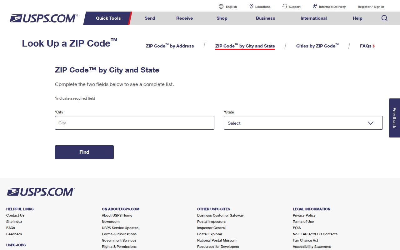
Run the appropriate USPS mode before copying a postal label into a request, parcel note, or historical search log. A returned ZIP does not confirm that a named person or organization is at the address.
Fort Lee Portal ZIP Filter Gap
The Fort Lee Tax Assessor points to a county-linked property search, and the research identified a possible ZIP control in the linked portal. Its live rendering did not expose that control, its label, or what a result returns. For that reason, a ZIP search should be tested in a normal browser before it is used as a property-research method. The known verified entry paths are owner name, physical or situs address, Fort Lee municipal context, block, lot, and parcel or PAMS identifier.
| Potential field | What research supports |
|---|---|
| Owner name | Optional name search; test spelling and initial variants. |
| Property or situs address | Optional physical Fort Lee parcel address; portal spelling must match. |
| Municipality | Fort Lee or Bergen County context; current control label needs verification. |
| Block and lot | Optional legal tax-map identifiers. |
| Parcel or PAMS identifier | Optional cross-check with Bergen GIS where available. |
| ZIP | Possible filter only; no live control or output was verified in the inspected rendering. |
The Fort Lee Tax Assessor and county-linked property search are the official starting channels. The assessor counter and a record-specific OPRA request remain alternatives when the online interface cannot answer a narrow property question.
Note: A possible ZIP field must be tested live before it is treated as a valid property-search filter or result category.
Find Residents in a Fort Lee ZIP
Postal information can organize a careful search, but it is not a ZIP-wide household roll. Start by validating the address with USPS. If a current property question follows, test the property portal's live controls and use the Bergen parcel viewer to confirm the Fort Lee municipal parcel. The voter system includes ZIP among statutory registry fields, yet the public status page was blocked to inspection and no ZIP-wide public search was verified. Do not infer a bulk result from an individual status tool.
- Verify the street address, city, and ZIP with the USPS mode that fits the question.
- Test the county-linked property search by situs address, owner, block, lot, or a live ZIP field if one appears.
- Confirm the parcel's municipality and identifiers in the Bergen County Parcel Viewer.
- Use the New Jersey voter status check only for a submitted individual status question, subject to its current form and restrictions.
- Send a narrow request to the right custodian if the needed non-exempt record is not online.
Once a ZIP has narrowed an address, use the Fort Lee street directory for the distinct street-and-parcel workflow. That route handles address-keyed records rather than turning the postal area into a resident list.
Fort Lee ZIP Research Boundaries
Each official source answers a different question. USPS validates a mailing and delivery relationship. The Fort Lee Tax Assessor supplies tax and assessment context. The Bergen County Parcel Viewer supplies parcel shape, municipality, block, lot, PAMS_PIN, and map context. The Bergen County Clerk's Bergen County Land Records Search supplies recorded transfer information from January 1, 1970 forward. None of these sources establishes every person who may be present at a property.
The Bergen County Parcel Viewer is useful for the municipal and parcel check. It has parcel, tax-map, municipality, and county layers, plus identify, query, find, and map-export functions. The inspected service does not document a ZIP attribute, so it should not be described as a ZIP search tool.
Fort Lee ZIPs and Borough Lines
Postal boundaries are routing areas, not legal borough boundaries. A Fort Lee mailing label, a 07024 delivery result, a tax municipality, and a parcel's situs can point to different parts of the same address story. The municipal boundary should be tested through the GIS municipality and parcel layer. The assessor identifies tax jurisdiction. A deed and legal description address recorded property rights. USPS supplies the delivery check. Their answers should be compared, not substituted for one another.
- ZIP and ZIP+4
- A ZIP identifies a postal delivery area; ZIP+4 adds a narrower delivery segment for a particular address range or destination.
- PO-box ZIP
- A ZIP used for post-office boxes. No Fort Lee PO-box-only assignment was verified in the research.
- Unique ZIP
- A ZIP assigned to one organization or destination. No Fort Lee unique assignment was verified in the research.
- Carrier route
- A delivery sequence used by postal carriers. It is not a municipal boundary or a resident roster.
Note: Do not assign an address to Fort Lee from a generic city label when the postal, parcel, and legal records have not been reconciled.
Fort Lee Address Keys by ZIP
Keep four address keys separate when researching Fort Lee: situs, mailing address, legal description, and ZIP. Situs identifies the physical parcel. A mailing address tells the tax office where to send a notice and may be elsewhere. The legal description uses durable property identifiers such as block and lot. The ZIP is the postal routing label. A research note should also preserve municipality, PAMS_PIN, street spelling, and historical section name where available.
This separation is especially important when records seem to conflict. A parcel can have a Fort Lee situs and a different mailing address, while an older document may use Ridgefield Township, Coytesville, Palisades, or another historical label. Comparing the parcel shape and legal identifiers is more dependable than relying on one postal phrase.
Historical Fort Lee ZIP Search Terms
Fort Lee was formed from the remaining portions of Ridgefield Township on March 29, 1904. The historical name change matters because pre-borough deeds, directories, maps, and tax material may use Ridgefield Township or village and section names instead of the modern postal label. County historic references include the Village of Taylorville map filed in 1853 and the Pond Park at Fort Lee Village map filed in 1864.
Coytesville and Palisades also appear in Fort Lee map and catalog contexts. Princeton's digitized Sanborn series includes local sheets for 1908, 1911, 1923, and 1930. Use a historical name to expand an archive search, then reconcile the result against a dated map, parcel, block and lot, or deed description. It is a geographic lead, not proof of a modern mailing address.
Note: A historic section name broadens an archive search, but it must be checked against a dated map or legal parcel identifier.
Fort Lee Postal Requests Under OPRA
When postal verification, the assessor, and GIS do not resolve a narrow public-record question, the fallback is a request to the correct custodian under the New Jersey Open Public Records Act. Name the address, date range, record type, and requested delivery method. Fort Lee provides an OPRA request form. OPRA does not override court rules, statutory confidentiality, protected addresses, or other exemptions.
A Fort Lee postal lookup can identify the correct starting point, but it cannot replace the custodian's record. Keep the request limited to the parcel, document, or municipal record actually needed. This improves the chance of a useful response and respects the boundary between public information and protected personal data.
Note: A custodian may withhold protected information even when an address, postal label, or general record category is known.