
Fort Lee Neighbors by Block
The public trail around a Fort Lee address is parcel-based, not person-based. Start by locating the parcel, then use the map boundary, street frontage, and adjacent lots to identify nearby legal parcels. The assessor or county-linked property search can then provide an owner or tax context for one selected parcel. Bergen land records can add a recorded transfer trail. None of those sources proves who occupies every unit, so a neighbor question must stay narrower than a household roster.
Community sources add a different layer. The Borough resource directory and the Fort Lee Regional Chamber directory identify public organizations and business contacts, not private residents. Historic maps and directories can help explain an older block. The lead table distinguishes the evidence each source can provide and the limits that remain.
| Source | What It Shows About a Block | Access |
|---|---|---|
| Bergen County Parcel Viewer | Parcel boundaries, street context, municipality, block, lot, PAMS_PIN, and map layers | Public viewer with identify, find, query, and export operations |
| Fort Lee property search | Owner and tax-record context for a selected parcel, including situs versus mailing distinction | Public search with assessor-counter fallback |
| Bergen land-record index | Recorded parties, transfers, document dates, and legal-property references | Public online index from January 1, 1970 |
| NJ voter-status check | Individual status only if the official tool returns a record | Not a verified public block-wide export |
| Community and historical sources | Public organization contacts, older street context, or built-form history | Borough, Chamber, library, historical-society, and map routes |
An owner record and a resident record answer different questions. The tax mailing address can belong to an owner, fiduciary, lender, or business. The physical situs identifies the parcel. A Fort Lee neighbor lookup should say only what the actual record supports.
Fort Lee Parcel Map Controls
The Bergen County Parcel Viewer is the spatial starting point for Fort Lee parcel work. Its documented service layers include TAX MAPS, PARCELS, MUNICIPALITY, and BERGEN COUNTY. Use the map to understand which parcels are adjacent, across a street, or separated by an alley or right-of-way. The relevant operations are pan and zoom, parcel click, identify, find, query, layer toggles, and export map. A buffer or select-by-location control was not verified in the inspected viewer, so it should not be assumed.
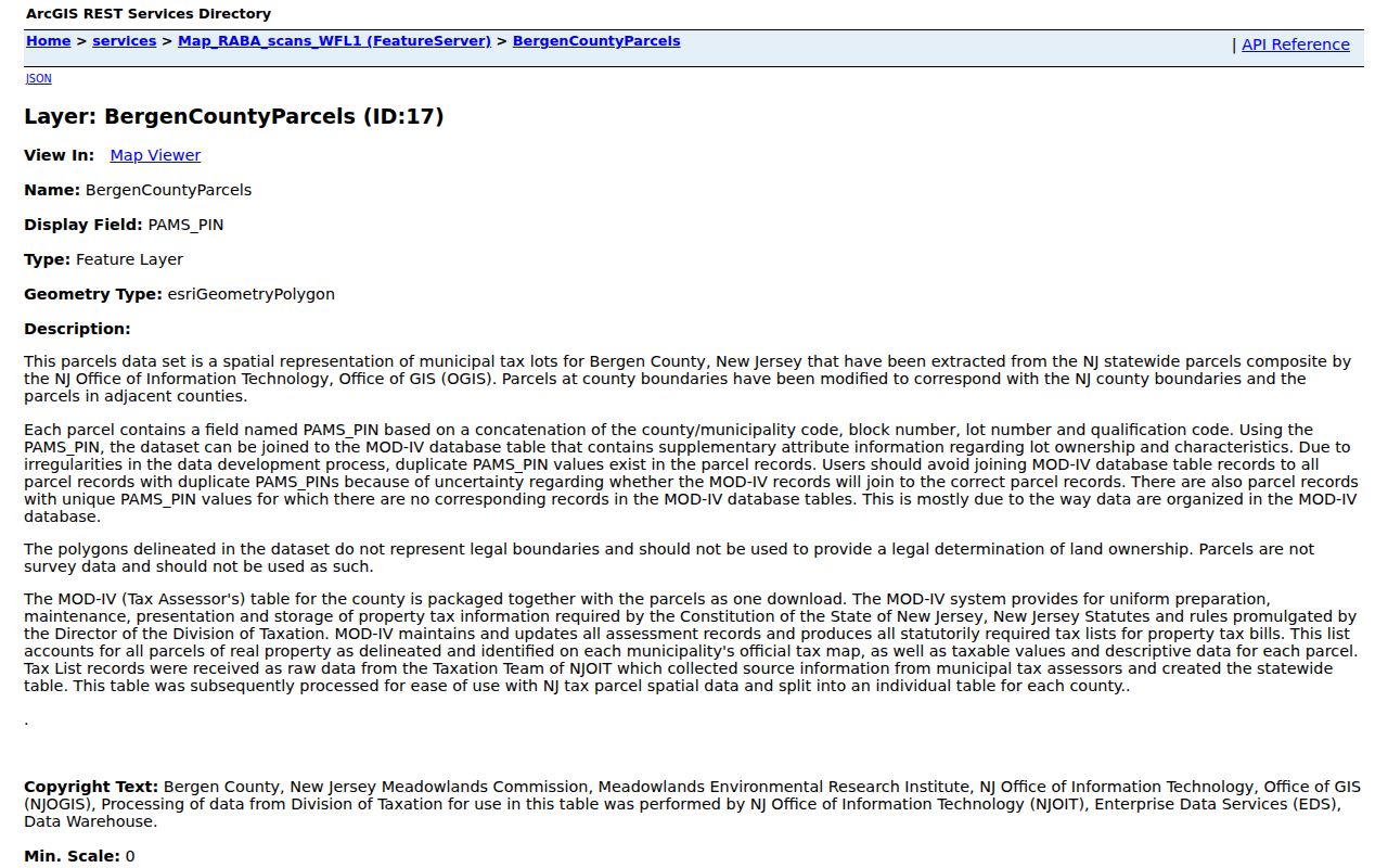
The selected parcel may expose PAMS_PIN, MUN, BLOCK, LOT, QCODE, LASTUPDATE, geometry, and taxable descriptive data. PAMS_PIN is a composite county, municipality, block, lot, and qualification key. It is valuable when a street label changes or a common address creates confusion. LASTUPDATE is a freshness clue, not a guarantee that every linked owner field has changed on the same day.
The Bergen parcel-layer reference shows the kind of PAMS_PIN, municipality, block, lot, qualification, update-date, and geometry attributes available for block work.
Copy only the parcel identifiers needed to continue the official search. The geometry helps establish adjacency, but a polygon does not disclose a complete list of people at that location.
- Parcel
- A defined piece of land represented on the tax map and used for assessment and recording work.
- Block and lot
- Legal-tax identifiers that connect the map, assessor record, and land-record search more reliably than a street label alone.
- PAMS_PIN
- A county parcel identifier that combines jurisdiction and parcel elements; qualified interests can create more than one related entry.
- Situs address
- The physical property address. It should be kept distinct from the address where a tax bill is sent.
Map Fort Lee Neighbor Parcels
Use a fixed sequence for the few parcels directly around an address. It keeps the research tied to map relationships instead of a broad name search. The map and tax record should be treated as separate evidence, then the land index can be used only where a recorded document is needed. A complete named-street chain requires a different, parcel-by-parcel method described in the Fort Lee street directory.
- Find the starting Fort Lee address in the Bergen viewer and confirm the visible parcel boundary against the street.
- Click each parcel that shares a boundary or the immediate frontage, then record its PAMS_PIN, municipality, block, lot, QCODE, and LASTUPDATE.
- Search each selected identifier or owner through the Fort Lee assessor or county-linked property route, keeping situs and tax-mailing fields apart.
- Use block and lot or the recorded party name in the Bergen County Land Records Search when a transfer, deed, mortgage, lien, or document date matters.
- For a record before the online land-index range, ask the County Clerk, State Archives, historical society, or library for the older-book and archive route.
The reliable flow is address to map parcel, parcel keys to tax context, then legal identifiers to recorded documents. It does not become address to every neighbor, because unrecorded occupants, household members, guests, and protected people can be absent from the public sources.
For address-dated work or enforcement evidence, Fort Lee's Building Department and Code Enforcement are additional municipal channels. No public online permit or code-case search was located. Ask for a specific address and date range by phone, in person, or through an OPRA request, and expect protected details to be redacted or withheld where required.
Note: A mapped boundary is useful for selecting nearby parcels, but it does not confirm occupancy, contact preferences, or relationships between the people connected with them.
Fort Lee Community Contacts
Fort Lee's civic directory layer is useful when the goal is to find a public contact point near a block. In Fort Lee, the Borough's community/resource directory supports category, first-letter, name, and result browsing. Its observed entries include the Fort Lee Historical Society, Fort Lee Museum, and Fort Lee Film Commission. These are organizational contacts, not a list of neighbors. The Chamber likewise offers searchable business and organization information for Fort Lee and nearby Bergen river towns.
The Fort Lee Regional Chamber member directory can be searched by keyword, category, or alphabet for public organization and business context.
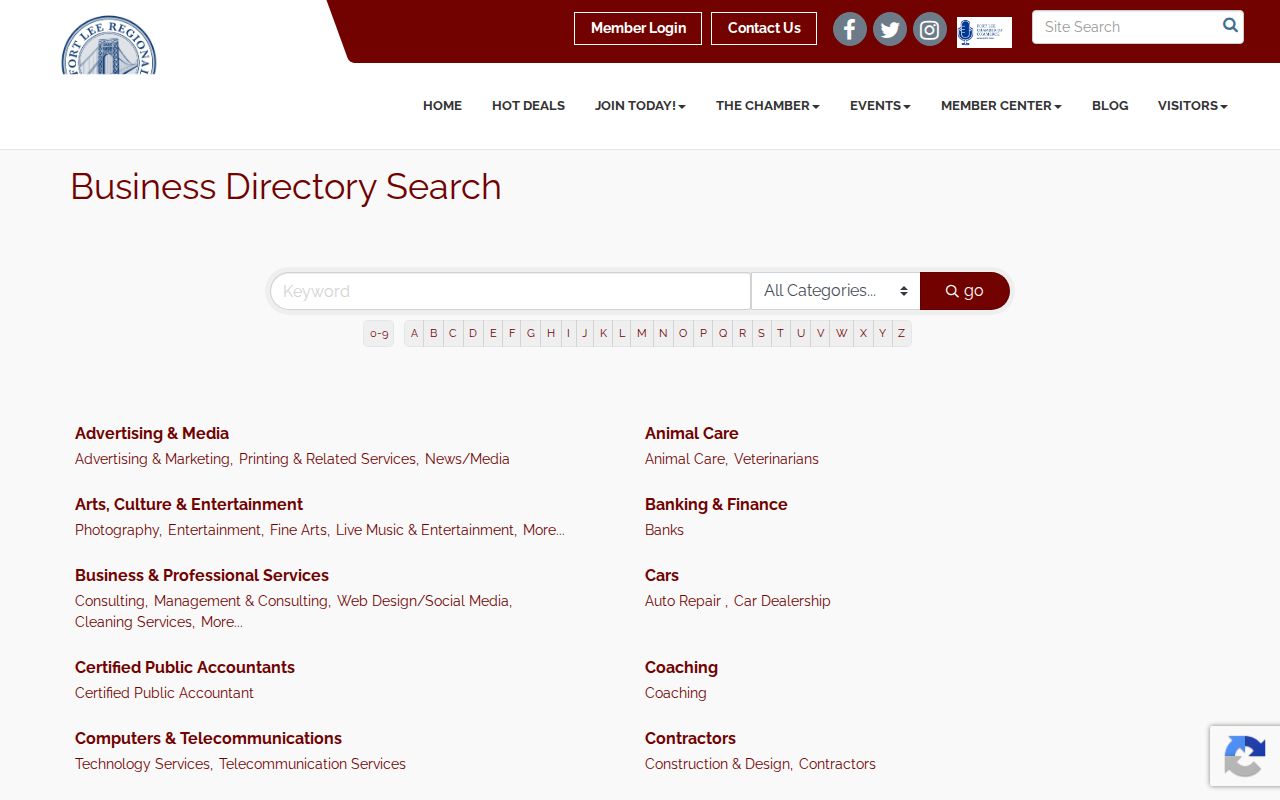
A Chamber result describes a member organization or business. It should never be re-labeled as a household record or evidence of where a person lives.
Fort Lee resource directory
Borough category directory offers public organization contacts through category, letter, and name routes.
Fort Lee Regional Chamber
Chamber contacts and guides provide a public organization and business layer across Fort Lee and nearby communities.
Fort Lee Historical Society
County resources list the society at 1589 Parker Avenue, 201-592-3580, for local-history and public collection questions.
Fort Lee Museum
County listings identify the museum at 1588 Palisade Avenue, 201-592-3663, as a public historical resource.
The official Fort Lee directory reference demonstrates its category and name-based public-contact format.
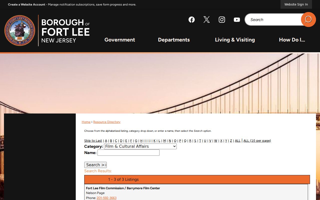
Use these entries to contact an organization or locate a civic resource, not to infer private membership. No public neighborhood-HOA roster was located, and the Korean American Association of Fort Lee and the Fort Lee Chinese American Community Association were not found to publish member lists.
Fort Lee Neighbors and Voters
New Jersey's official registration-status tool is a confirmation route for an individual search, not a lawful Fort Lee block directory. The inspected Fort Lee status endpoint did not expose its live field labels because it returned a 403 during research. The statewide system can contain a residence address, municipality, ZIP, district, party, and participation history, but the public status display does not necessarily expose all of those fields. Sensitive identifiers, signatures, confidential information, and protected addresses are not for reproduction.
Bergen elections offices can help with registration forms and status questions. A full-file order form, price, format, and current delivery procedure were not found in the inspected official material, so no bulk route should be assumed. N.J.S.A. 19:31-18 and 19:31-31 regulate voter information and prohibit commercial or charitable solicitation from registry data. Participation history does not reveal a ballot choice, and inactive status does not prove a person never lived at the address.
For an address-specific public question that lacks an online route, a narrow request to the appropriate elections or municipal custodian is more accurate than attempting to assemble a block list from status checks. Protected voter information under N.J.S.A. 19:31-3.2 remains outside that approach.
Fort Lee Neighbor Tools Compared
Official records and compiled commercial neighbor tools serve different purposes. The official source reveals the specific public record it keeps, its date, and the responsible custodian. A commercial category may combine older public filings with purchased data, which can be stale, merge people with the same name, omit protected people, or create false associations. Neither category fills the privacy gaps around a Fort Lee block.
| Official record route | Compiled commercial category |
|---|---|
| Shows the custody, record type, date, and legal parcel or case context. | May combine sources with varying update schedules and matching methods. |
| Can be checked with the assessor, County Clerk, court, elections office, or Borough custodian. | May contain old or merged details that need independent confirmation. |
| Retains legal redactions and access limits. | Does not override protected-address, court, vital, or motor-vehicle limits. |
For a neighbor question, choose the official source that answers only the needed point: adjacency from GIS, owner of record from the tax route, recorded party and date from the deed index, or a public organization contact from a civic directory. Confirm a material fact with its custodian instead of relying on a compiled profile.
Fort Lee Sanborn Block Story
A block can have an older physical story even when a present-day parcel record is thin. Princeton University's digitized Fort Lee Sanborn series provides map snapshots for 1908, 1911, 1923, and 1930. The catalog includes 1908 sheets 1 through 7, 1911 Fort Lee and Coytesville-related sheets, 1923 sheets that include Palisades, and a longer 1930 sequence. These maps can show when a structure, street segment, theater, school, club, shop, or industrial use appears on the block.
The maps are not an occupant list. Pair a map footprint with a deed date, directory or yearbook evidence, census schedule, permit request, or local newspaper item before making a historical connection. Fort Lee's formation from Ridgefield Township on March 29, 1904 also means older searches may require Ridgefield, Coytesville, Palisades, or other section names. That name change is a search aid, not proof that an old entry describes a particular modern address.
Fort Lee Neighbor Privacy
What stays private around a block is as important as what the parcel map shows. Public sources do not provide a dependable list of non-owner occupants, household members, delivery or utility customers, protected voter addresses, motor-vehicle information, juvenile or victim data, or private association rosters. New Jersey's Address Confidentiality Program and Daniel's Law can lawfully suppress or alter address information for qualifying or covered people.
When a map, owner record, or public directory leaves a gap, do not try to defeat that gap with a different search. Contact a public organization through its listed channel, ask the appropriate custodian for a defined record, or stop when the record is protected. A wrong or stale record should be corrected with the office that maintains it.