
Walk a Fort Lee Street
Start with one Fort Lee address and keep the street number, street spelling, ZIP, and municipality together in your notes. The assessor and county-linked property search are the entry points for an owner or physical parcel. The Bergen parcel viewer then places that parcel among its neighbors and supplies the legal identifiers that survive minor differences in address wording. The deed index is the next stop for recorded transfers. A voter-status result, if the official tool returns one, is only a narrow confirmation channel, not a street-wide list.
- Search the Fort Lee Tax Assessor’s linked property system by situs address. If a name is already known, try owner-name variants as well.
- Open the same parcel in the Bergen County viewer. Record its block, lot, PAMS_PIN, municipality, QCODE, and LASTUPDATE value.
- Use the owner and legal identifiers in the Bergen County Clerk land index. Narrow a broad result with Fort Lee, a date range, document type, and a second party.
- For a person-specific question, use the New Jersey registration-status check only as its live result permits. Do not turn the tool into a by-street roster.
- For an older address, ask Fort Lee Public Library whether a reverse or criss-cross directory, newspaper, or map source covers the needed period.
That order separates a mapped parcel from an ownership record, a recorded transaction, and a historical address listing. It also makes it easier to spot a mismatch before a name is attached to the wrong Fort Lee property.
Fort Lee Street Directory Fields
The Fort Lee Tax Assessor maintains assessment records and tax maps with the municipal engineer. Its county-linked property-search landing page supports an owner or property-address starting point, although the full live parcel card was not exposed during research. Use the published fields as a search plan, then confirm the exact current labels in a normal browser rather than assuming an unverified control is present.
| Property-search field | How it helps a street search | Research status |
|---|---|---|
| Owner name | Finds a parcel when the address is incomplete; try surname, initials, and entity variants. | Available as an owner-search route; exact live syntax unverified. |
| Property or situs address | Locates the physical Fort Lee parcel by number and street spelling. | Verified entry route; current field layout unverified. |
| Municipality | Keeps the result in the Fort Lee and Bergen County context. | Control label may be fixed or selectable. |
| Block and lot | Bridges the tax map to deed and GIS records when street wording changes. | Legal tax-map identifiers. |
| Parcel or PAMS identifier | Cross-checks the property record against the GIS feature. | Use when the current portal exposes it. |
Assessment flags, values, mailing data, and structural details have different meanings. They describe the parcel or tax administration. They do not establish every person who may be present at an address.
Fort Lee Streets on Bergen GIS
The Bergen County Parcel Viewer is the spatial part of a Fort Lee street directory search. Turn on PARCELS and TAX MAPS, then use a map click, Identify, Find, or Query operation to reach a parcel. The service exposes PAMS_PIN, municipality, block, lot, QCODE, LASTUPDATE, geometry, and map-layer context. A parcel boundary helps with frontage and nearby lots, but it is not a deed record or a household record.
- Parcel
- A mapped tax or land unit, identified in Fort Lee by legal keys such as block and lot.
- Situs address
- The physical address of the parcel used for maps, inspections, and address-based records.
- Plat
- A recorded map reference that may appear in a deed’s legal-description trail and can help identify land beyond a street label.
- Criss-cross directory
- An address-to-name directory format, if a library holds it, used to work from a street number back to a historical listing.
Record LASTUPDATE as a map freshness clue, not as a transfer date. The assessor and Clerk’s index remain the better sources for an owner context and recorded document history.
Fort Lee Situs and Mailing Records
A Fort Lee parcel can carry two addresses with different uses. The situs address marks the actual property. The mailing address says where a tax notice is sent, which may be a business, fiduciary, lender, or a place outside Fort Lee. Treat a mailing address as a clue for the record trail, not proof that the recipient lives on the parcel. This distinction is especially important where an address search seems to produce a familiar name but the physical and mailing locations differ.
Block, lot, PAMS_PIN, and a legal description provide a more durable bridge between the assessor, GIS service, and County Clerk index. A street number can change or appear with a different section label in older material. No official boroughwide renumbering or street-renaming year was located, so research should not invent one. Compare the legal identifiers and parcel shape before deciding that two Fort Lee addresses describe the same place.
Note: A property-owner record identifies an ownership connection; it does not create a complete list of current Fort Lee occupants.
Fort Lee Street Records by Address
The Fort Lee street directory is strongest when each address-keyed source is used for its own evidence. The assessor identifies the parcel and ownership context. GIS shows where it sits. The County Clerk index records transfers and instruments. Municipal offices may hold address-dated permits or enforcement records, while older directory and map sources can add historical context. None of these sources is a single, complete list of the people on a street.
| Address record | Fort Lee or Bergen keeper | What it can show | Access route |
|---|---|---|---|
| Assessment/property card | Fort Lee Tax Assessor | Owner context, situs, mailing address, block/lot, assessment facts as displayed. | County-linked search, assessor counter, or OPRA where appropriate. |
| Parcel map | Bergen County Parcel Viewer | Boundary, municipality, block, lot, PAMS_PIN, QCODE, and map layers. | Free Identify, Query, Find, and export-map service. |
| Recorded instruments | Bergen County Clerk Land Records | Parties, document type, recorded date, legal description, and references. | Free online index from January 1, 1970; earlier office and archive route. |
| Building or code file | Fort Lee Building Department or Code Enforcement | Address-specific work, inspection, or case evidence if releasable. | No public online case index located; request by address and date range. |
| Historical address listing | Library and historical collections | Possible address-to-name or business listing in a confirmed reverse directory. | Exact Fort Lee years unverified; ask reference staff. |
The chain runs from street address to parcel key, then to owner and recorded document. A voter status result can supplement a submitted name when the official system returns one, but New Jersey’s protected-address and use rules mean it cannot fill the gaps left by the parcel records.
Fort Lee Deeds Along a Street
The Bergen County Land Records Search is the legal-document layer for an address. Its online document range begins January 1, 1970. The public index supports Party Name, Second Party Name, More Names, document type, town or municipality, dates, instrument number, book/page, and block/lot. The help guidance recommends spelling variants, automatic wildcard searching, and ALL/ANY logic when a common name produces too many results.
Use a Fort Lee result’s owner, block, and lot to narrow the search. A result may identify a deed, mortgage, release, lien, lis pendens, or another instrument. Record the party names as indexed, document type, recording date, instrument number or book/page, legal description, and any prior-reference language. Each party appears on a separate result line, so use the F2 detail control and F5 image control where available, then confirm image availability for the specific record.
The public land-record search shows the two browser paths available for Fort Lee document research.
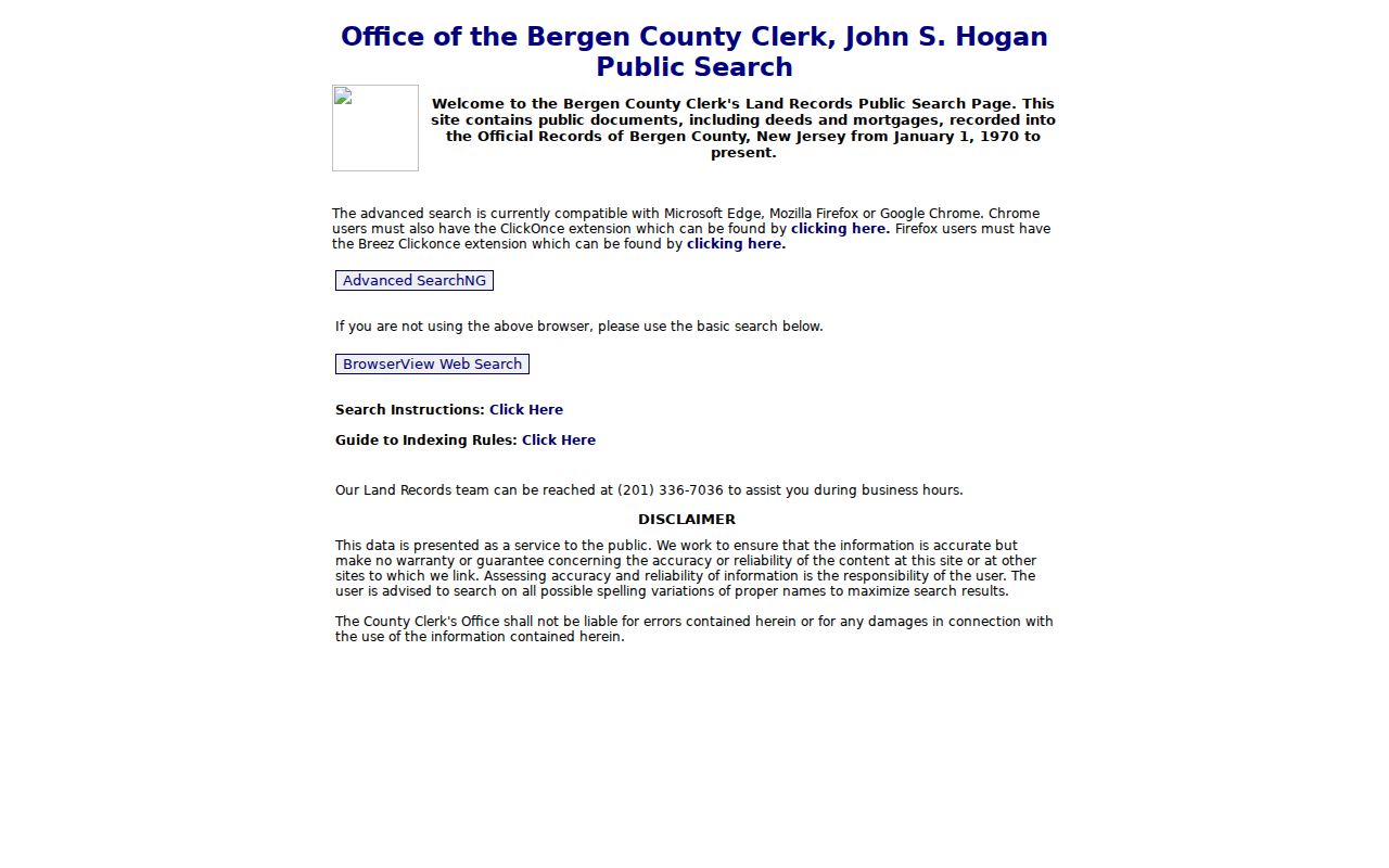
Advanced SearchNG offers fuller criteria, while BrowserView is the documented fallback when the advanced browser support will not launch. The index is free to search, but copy or recording charges are separate from the search itself.
Fort Lee Permit Trails
Permit history can date change to a Fort Lee structure even when it does not name every person connected with the address. In a street directory investigation, the assessor says that a building permit can trigger visits by the assessor and construction official. Added assessment can begin in the month after substantial completion, occupancy, or use, while a demolition may remain reflected through the relevant assessment cycle before changing in the next year.
The Fort Lee Building Department handles building, electrical, fire, plumbing, zoning, and subcode permits, inspections, and certificates. Its physical office is at 1365 Inwood Terrace, and the published phone route is 201-592-3500 extension 1503. No public online Fort Lee permit-case search was located. Ask for a specific address and date range by phone or in person, or make a focused request through the Borough Clerk under the New Jersey Open Public Records Act when the record is eligible for release.
Fort Lee’s 1970 Deed Handoff
The January 1, 1970 start of the online Bergen land portal is an important Fort Lee research quirk. It marks a handoff, not the beginning of local ownership. When a street’s transfer trail reaches that date, move to Bergen County Clerk office records, deed books and indexes, State Archives land material, or Bergen County Historical Society collections. A complete title story cannot be inferred from the online portal alone.
Older Fort Lee material may also use names that predate the borough. Fort Lee was formed from remaining Ridgefield Township portions on March 29, 1904. Search Ridgefield Township as well as Fort Lee, Coytesville, Palisades, and Village of Taylorville when the legal description or map points there. The County Clerk’s historic material includes a Village of Taylorville map filed in 1853 and a Pond Park at Fort Lee Village map filed in 1864.
Fort Lee Street Directory Gaps
Reverse and criss-cross directories can turn an old Fort Lee address into a name or business listing, but no exact Fort Lee run was verified in the public research. Fort Lee Public Library offers in-person help, public computers, scanning, copying, and Ask a Librarian. Give the reference desk the address, borough and county, likely years, and any older section name. Ask staff to check city, regional Englewood or Northern Valley, telephone, reverse, criss-cross, newspaper, obituary, yearbook, and local-history titles.
The historical collections themselves deserve a separate search when the goal is a household trail. The Fort Lee city directory collections page explains how directory shelves, regional volumes, and census pairing fit that task. For a street question, preserve original spellings and labels rather than silently changing them to a modern street form.
Note: The public research found no verified Fort Lee directory publisher, year run, or boroughwide readdressing date to state as fact.
Limits of a Fort Lee Street Directory
A Fort Lee street directory cannot prove every person connected with an address. Parcel, deed, and map systems identify property facts and recorded parties. They do not supply a complete list of non-owner occupants, children, guests, utility customers, delivery recipients, or people who do not appear in the narrow public record being searched. The official voter-status tool has protected-address and sensitive-field limits, and an inactive registration does not mean someone never lived at the address.
Motor-vehicle personal information is restricted by the federal Driver’s Privacy Protection Act and New Jersey MVC rules. The New Jersey Address Confidentiality Program and Daniel’s Law can also shield qualifying or covered people. Court and OPRA rules add redaction limits for victim, juvenile, family, sealed, and other protected material. If an address is suppressed, do not try to reconstruct it through another source.
Lawful use. Fort Lee address records are for personal, lawful research and property history. Do not use a record to stalk, harass, intimidate, or track a living person.